
GCSE Geography Tricky Topics: Hard Engineering River Management
Georgia Grigor
Content Officer
Published
4 min read

Master hard engineering river management for GCSE Geography. Learn the definitions, advantages and disadvantages of dams, reservoirs, embankments, and more.
River flood management is a core topic that examiners regularly test through both definition questions and evaluation tasks. To secure top marks, you need to know the exact definitions of hard engineering strategies and weigh up their specific advantages and disadvantages.
key points
Key takeaways
Hard engineering refers to human-produced structures used to reduce the risk of flooding and control rivers.
Dams and reservoirs can be used to supply drinking water and to generate hydroelectric power.
Embankments allow a river channel to hold more water, making flooding less likely but can be expensive and vulnerable to breaking.
Channel straightening speeds up water flow by removing meanders, which can cause flooding and erosion downstream.
Flood relief channels divert water away from important areas but may cause flooding further downstream where they rejoin the main river.
hard engineering strategies
Hard engineering River Management for GCSE Geography
Hard engineering refers to human-produced structures used to reduce the risk of flooding and control rivers. These structures are made by humans rather than occurring naturally (unlike the erosion of cliffs), so they are described as artificial.
Examiners expect you to recognise that dams, reservoirs, embankments, channel straightening and flood relief channels are all examples of hard engineering – not soft engineering [1].
Quick Knowledge Check Question:
Hard engineering.
Hard engineering specifically refers to artificial, human-made structures built to control rivers and lower flood risk.
dams and reservoirs
How do Dams and Reservoirs work in River Management
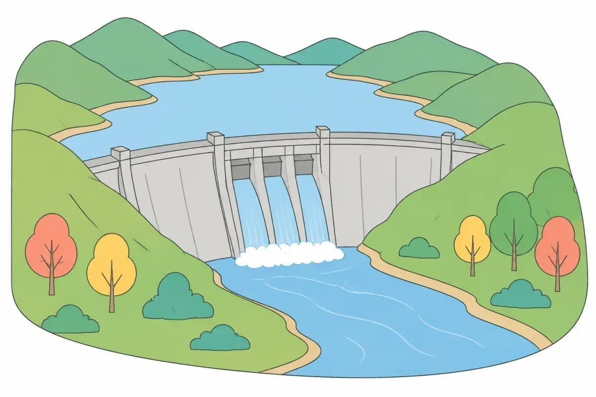
Dams are huge walls built across rivers to trap and control the flow of water further down the river's course. Behind these rivers, reservoirs are formed – these are artificial lakes used to store and supply water to an area.
When flowing water is released from reservoirs held behind a dam, it can also be used for hydroelectric power, which is the process of generating power from that moving water [2].
Advantages
Dams and reservoirs can be used to supply drinking water and to generate hydroelectric power [2][3].
Disadvantages
Quick Knowledge Check Question:
They can be used for drinking water and to generate hydroelectric power.
Storing water in an artificial reservoir behind a dam provides a reliable drinking water supply and allows flowing water to generate hydroelectric power.
embankments and channel straightening
How do Embankments and Channel Straightening Manage River Flooding
Engineers can also alter the river channel itself to manage water levels and flow speed through embankments and channel straightening. Embankments are raised walls built along river banks, used to allow a river to hold more water without flooding.
Advantages
The river channel can hold more water, making it less likely to flood.
Disadvantages
They can be very expensive to build and they can break or be overwhelmed in times of excessive rainfall [6][7].
Channel Straightening involves artificially removing a river's meanders to give it a more direct course.
Advantages
Water moves out of the area more quickly because it has a more direct route.
Disadvantages
It can cause flooding and erosion issues further downstream because the water moves faster [8].
Quick Knowledge Check Question:
They can cause flooding and erosion issues further downstream as the water is faster.
Giving a river a more direct course speeds up the water, transferring flooding and erosion problems further downstream.
flood relief channels
What are Flood Relief Channels and their Effects
Flood relief channels are additional streams and canals that divert water away from important areas when the water level is too high [9]. Like dams, embankments, and channel straightening, they are a hard-engineering strategy.
Advantages
They can prevent flooding by controlling and redistributing the river discharge.
Disadvantages
They may cause flooding further downstream where the relief channels rejoin the main river.
Quick Knowledge Check Question:
They may cause flooding further downstream where the relief channels rejoin the river.
While relief channels protect important areas by diverting water, reintroducing that water later can trigger flooding further downstream.
exam tip
Grade 9 Exam Tip
When answering evaluation questions under timed conditions, always link the mechanism of the hard-engineering structure directly to its downstream impact. Examiners award top marks when you explain why a solution works locally (for example, channel straightening removes meanders so water leaves quickly) while recognising how that exact mechanism creates a new problem elsewhere (faster water causes flooding and erosion further downstream).
Frequently asked questions
Dams are the huge walls built across rivers to trap and control the flow of water further down the river's course, whereas reservoirs are the artificial lakes created behind those dammed rivers to store and supply water to an area.
Hydroelectric power is generated using flowing water released from reservoirs being held behind a dam.
By artificially removing a river's meanders to give it a more direct course, water moves out of the area more quickly.
Embankments are raised walls built along river banks that allow the river channel to hold more water, making it less likely to flood.
References
AQA. (n.d.). GCSE Geography (8035) specification: 3.1 Living with the physical environment. https://www.aqa.org.uk/subjects/geography/gcse/geography-8035/specification/subject-content/living-with-the-physical-environment
Department for Energy Security and Net Zero, & Environment Agency. (2013). Harnessing hydroelectric power. GOV.UK. https://www.gov.uk/harnessing-hydroelectric-power
Balmforth, D. (2021). Independent reservoir safety review report. Department for Environment, Food & Rural Affairs. https://assets.publishing.service.gov.uk/media/609a8fe28fa8f56a34b10ee8/reservoir-safety-review-report.pdf
Derbyshire County Council. (n.d.). MDR2203: Submerged village of Derwent, Ladybower Reservoir, Derwent. Derbyshire Historic Environment Record. https://her.derbyshire.gov.uk/Monument/MDR2203
The Open University. (n.d.). Surface water: 3.4.5 Sediment loss to agriculture. OpenLearn. https://www.open.edu/openlearn/nature-environment/environmental-studies/surface-water/content-section-3.4.5
Environment Agency, & Cumbria County Council. (2016). Carlisle flood investigation report: Flood event 5-6th December 2015. https://www.cumberland.gov.uk/sites/default/files/2024-08/section_19_flood_investigation_report_carlisle_-_2015.pdf
Environment Agency. (2019, June 18). Flood response at Wainfleet in Lincolnshire. Environment Agency blog. https://environmentagency.blog.gov.uk/2019/06/18/flood-response-at-wainfleet-in-lincolnshire/
Entwistle, N., & Heritage, G. (2020, June 2). Letting rivers run wild could reduce UK flooding: New research. The Conversation. https://theconversation.com/letting-rivers-run-wild-could-reduce-uk-flooding-new-research-138037
Environment Agency. (2025). Jubilee flood relief channel. GOV.UK. https://www.gov.uk/government/publications/jubilee-river-flood-alleviation-scheme/jubilee-river-flood-alleviation-scheme
Tagged: Geography subject page, GCSE, Revision, Tricky GCSE Topics